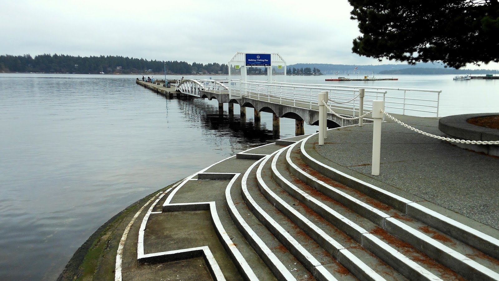
- View on Panoramio
- Tags: 2014, Barkley Sound, British Columbia, Canada, frtzw906, island, Kildonan,
Vancouver Island, water,
Picture taken here: 48° 59' 30.05" N 124° 59' 31.20" W
Pictures from my Panoramio (frtzw906) account - mostly of British Columbia
Sunday, 12 April 2015
Port Alberni - Get-away on Cheeyah Island
On our October journey with the MV Frances Barkley from Port Alberni to Bamfield, our first stop was Cheeyah Island. This seemed like a pretty posh get-away in the middle of nowhere. At this stop, the skipper pulled alongside the dock to drop a passenger off.
Saturday, 11 April 2015
Bamfield - Sorry, No Coffee Today
Having stepped off the MV Frances Barkley a few minutes before the monsoon-like rains started, I strolled along Bamfield's seawalk to this location. A coffee shop in the summer, I reckon.
- View on Panoramio
- Tags: 2014, Alberni, Bamfield, Barkley Sound, British Columbia, Canada, frtzw906, Vancouver Island,
water, - Picture taken here: 48° 49' 47.24" N 125° 8' 27.06" W
| Bamfield - Sorry, No Coffee Today |
Labels:
British Columbia,
Canada,
dock,
frtzw906,
Pacific Ocean,
Reise Fotos,
Reiseführer,
shore,
Vancouver Island,
water
Location:
Bamfield, BC V0R, Canada
Gulf Islands - Leaving Pirates Cove
On this day's kayak tour, Peter and I had launched at Cedar-by-the-Sea. After a nice paddle along the west shore of Link Island, we had slipped through the hole-in-the-wall (between Link and DeCourcy Islands) toward Pirates Cove. After a snack at the cove, we headed back. Here we're in the narrow passage exiting Pirates Cove.
- View on Panoramio
- Tags: 2014, British Columbia, Canada, De Courcy Island, frtzw906, island, shore, Vancouver Island, water,
- Picture taken here: 49° 5' 53.05" N 123° 44' 1.14" W
| Gulf Islands - Leaving Pirates Cove |
Labels:
boat,
British Columbia,
Canada,
frtzw906,
Gulf Islands,
island,
Nanaimo,
park,
Reise Fotos,
Reiseführer,
Salish sea,
shore,
Vancouver Island,
water
Friday, 10 April 2015
Bamfield - Walking the seawalk
We're in Bamfield, walking the seawalk. In the rain. Of course! The MV Frances Barkley had just dropped us off at the dock by the Canadian Coast Guard Station and what should occur? We're in Bamfield. Rain. Actually: monsoon.
- View on Panoramio
- Tags: 2014, Alberni, Bamfield, BarkleySound, BritishColumbia, Canada, frtzw906, water, Vancouver Island
- Picture taken here: 48° 50' 3.36" N 125° 8' 22.68" W
Thursday, 9 April 2015
Nanaimo - Oyster Catcher in Departure Bay
Kilroy was here! Black Oyster Catcher in Departure Bay. When kayaking around Nanaimo, you're likely to hear the Oyster Catchers before you ever see them. When you hear them, be sure to look about for their characteristic orange beaks and the red-yellow eyes.
- View on Panoramio
- Tags: 2009, bird, British Columbia, Canada, frtzw906, Nanaimo, picnik, Vancouver Island, Departure Bay, water,
- Picture taken here: 49° 12' 23.37" N 123° 57' 40.72" W
| Nanaimo - Oyster Catcher in Departure Bay |
Labels:
British Columbia,
Canada,
frtzw906,
Nanaimo,
Reise Fotos,
Reiseführer,
Salish sea,
shore,
Tourism,
Vancouver Island,
water
Location:
Nanaimo, BC, Canada
Wednesday, 8 April 2015
Vancouver - Yaletown (Vancouver) seen from Granville Island
It may be November, but the sun flushes Vancouverites outdoors. An ideal spot to soak up some rays is out on the dock at Granville Island.
- View on Panoramio
- Tags: 2012, >100, >50, British Columbia, Canada, frtzw906, Granville Island, Vancouver,
- Picture taken here: 49° 16' 21.97" N 123° 8' 4.81" W
| Vancouver - Yaletown (Vancouver) seen from Granville Island... |
Tuesday, 7 April 2015
West Vancouver - A view to Bowen Island
BC Ferries vessel passing Bowen Island; as seen from Klootchman Park...
- View on Panoramio
- Tags: 2006, >100, >200, >50, BC, boat, British Columbia, Canada, ferry, frtzw906, park, Point Atkinson, Vancouver, water, West Vancouver,
- Picture taken here: 49° 20' 30.97" N 123° 16' 7.71" W
| BC Ferries vessel passing Bowen Island; as seen from Klootchman Park... |
Labels:
boat,
British Columbia,
Canada,
ferry,
frtzw906,
park,
Reise Fotos,
Reiseführer,
Salish sea,
shore,
Vancouver,
Vancouver Coast & Mountains,
water
Sunday, 5 April 2015
French Creek - Seagulls at herring season
Herring season at French Creek brings out all the looky-loos.
- View on Panoramio
- Tags: 2013, >100, >50, boat British Columbia, Canada, French Creek, frtzw906, Parksville, Vancouver Island,
- Picture taken here: 49° 20' 57.53" N 124° 21' 32.13" W
| French Creek - Seagulls at herring season |
Saturday, 4 April 2015
West Vancouver - Point Atkinson Lighthouse...
Taking a picture of Point Atkinson while kayaking out of Eagle Harbour...
- View on Panoramio
- Tags: 2006, BC, British Columbia, Canada, frtzw906, lighthouse, park, Point Atkinson, Vancouver, water, West Vancouver,
- Picture taken here: 49° 19' 52.04" N 123° 15' 56.13" W
| West Vancouver - Point Atkinson Lighthouse... |
Wednesday, 1 April 2015
Ucluelet - Saint Aidan-on-the-Hill church
Downtown Ucluelet with Saint Aidan-on-the-Hill church in the foreground. The aquarium, just down the hill is truly worth a visit.
- View on Panoramio
- Tags: 2015, British Columbia, Canada, church, frtzw906, Long Beach, Ucluelet, Vancouver Island,
- Picture taken here: 48° 56' 29.56" N 125° 32' 46.78" W
| Ucluelet - Saint Aidan-on-the-Hill church |
Tuesday, 24 March 2015
Port Alberni - Heading Into Barkley Sound
Port Alberni - Heading Into Barkley Sound: An overcast day but, if you're a true "Coast Head", this is "in your blood"...
- View on Panoramio
- Tags: 2009, Alberni, Barkley Sound, British Columbia, Broken Islands, Canada, frtzw906, July, Long Beach, Port Alberni, Sechart, ship, Ucluelet, Vancouver Island, water,
- Picture taken here: 49° 0' 4.76" N 125° 0' 39.42" W
| Port Alberni - Heading Into Barkley Sound |
Labels:
Alberni Valley,
boat,
British Columbia,
Canada,
frtzw906,
Google Earth,
Pacific Ocean,
Panoramio,
Reise Fotos,
Reiseführer,
Tofino,
Tourism,
Ucluelet,
Vancouver Island,
water
Location:
Alberni-Clayoquot A, BC, Canada
Monday, 23 March 2015
Cariboo - Hat Creek Ranch
Cariboo - Hat Creek Ranch; roadhouse/inn for stagecoaches travelling to and from the gold fields around Barkerville...
- View on Panoramio
- Tags: 2013 >50 British Columbia Canada Cariboo frtzw906
- Picture taken here: 50° 53' 8.64" N 121° 24' 34.49" W
 |
| Cariboo - Hat Creek Ranch |
Sunday, 22 March 2015
Tofino - Docks
Tofino Harbour; quintessentially WEsT Coast...
- View on Panoramio
- Tags:
- 2013
- >50
- boat
- British Columbia
- Canada
- frtzw906
- Long Beach
- Tofino
- Vancouver Island
- water
- Picture taken here: 49° 9' 16.45" N 125° 54' 36.98" W
 |
| Tofino Harbour; quintessentially WEsT Coast... |
Labels:
British Columbia,
Canada,
frtzw906,
Long Beach,
Panoramio,
Reise Fotos,
Reiseführer,
Tofino,
Vancouver Island
Location:
Tofino, BC, Canada
Saturday, 21 March 2015
Nanaimo - Floatplanes "Grounded" By Fog
Nanaimo - Can we say that the fog has this floatplanes fleet "grounded"?
- View on Panoramio
- Tags: 2013 >50 British Columbia Canada Nanaimo Vancouver Island water
- Picture taken here: 49° 10' 7.14" N 123° 56' 6.71"
Labels:
British Columbia,
Canada,
frtzw906,
Nanaimo,
Panoramio,
Reise Fotos,
Reiseführer,
Salish sea,
Vancouver Island
Location:
Nanaimo, BC, Canada
Cowichan Valley - Cowichan Bay Government Dock
Cowichan Valley - Cowichan Bay Government Dock
- View on Panoramio
- Tags: 2013, >100, boat, British Columbia, Canada, Cowichan Valley, frtzw906, Vancouver Island, water
- Picture taken here: 48° 44' 25.58" N 123° 37' 6.19" W
 |
| Cowichan Valley - Cowichan Bay Government Dock |
Labels:
boat,
British Columbia,
Canada,
Cowichan Valley,
dock,
frtzw906,
Panoramio,
Reise Fotos,
Reiseführer,
Vancouver Island,
water
Location:
Cowichan Bay, BC, Canada
Saanich - Pier At Brentwood Bay
Municipal pier at Brentwood Bay...
- View on Panoramio
- Tags:
- 2013 ,
- >100 ,
- boat ,
- Brentwood Bay,
- British Columbia,
- Canada,
- frtzw906,
- Saanich,
- Vancouver Island,
- water,
- Picture taken here: 48° 34' 20.62" N 123° 27' 44.68" W
 |
| Municipal pier at Brentwood Bay... |
Sidney - Sidney Spit...
Artefacts from a bygone era; Sidney Spit...
- View on Panoramio
- Tags:
- 2013
- >100
- beach
- British Columbia
- Canada
- frtzw906
- picnik
- Saanich
- Sidney
- Sidney Island
- Sidney Spit
- Vancouver Island
- water
- Picture taken here: 48° 38' 47.94" N 123° 20' 11.38" W
 |
| Artefacts from a bygone era; Sidney Spit... |
Labels:
beach,
British Columbia,
Canada,
frtzw906,
island,
Panoramio,
park,
Reise Fotos,
Reiseführer,
Saanich,
Vancouver Island,
water
Naramata - Kettle Valley Railroad Tunnel (Trans Canada Trail)
Little Tunnel on the KVR (Kettle Valley Railroad) Naramata section (Trans Canada Trail)...
- View on Panoramio
- Tags:
- 2013,
- British Columbia,
- Canada,
- frtzw906,
- KVR,
- lake,
- Naramata,
- TCT,
- trail,
- water,
- Picture taken here: 49° 37' 35.99" N 119° 35' 50.79" W
 |
| Little Tunnel on the KVR (Kettle Valley Railroad) Naramata section (Trans Canada Trail)... |
Ucluelet - Wickaninnish Centre At Long Beach
Ucluelet - Wickaninnish Centre At Long Beach, Kwisitis Visitor Centre...
- View on Panoramio
- Tags:
- 2013,
- beach,
- British Columbia,
- Canada,
- frtzw906,
- Long Beach,
- Ucluelet,
- Vancouver Island,
- water
- Picture taken here: 49° 0' 43.11" N 125° 40' 32.66" W
 |
| Ucluelet - Wickaninnish Centre At Long Beach, Kwisitis Visitor Centre... |
Labels:
beach,
British Columbia,
Canada,
frtzw906,
Long Beach,
Pacific Ocean,
Panoramio,
park,
Reise Fotos,
Reiseführer,
shore,
Ucluelet,
Vancouver Island,
water
Ucluelet - Long Beach Jetsam
Ucluelet - Long Beach Random jetsam... hope it's not radioactive Japanese Tsunami stuff?!
- View on Panoramio
- Tags:
- 2013,
- beach,
- British Columbia,
- Canada,
- frtzw906,
- Long Beach,
- Vancouver Island,
- Picture taken here: 49° 1' 4.05" N 125° 40' 31.10" W
 |
| Ucluelet - Long Beach Random jetsam... hope it's not radioactive Japanese Tsunami stuff?! |
Labels:
beach,
British Columbia,
Canada,
frtzw906,
Long Beach,
Pacific Ocean,
Panoramio,
Reise Fotos,
Reiseführer,
shore,
Ucluelet,
Vancouver Island,
water
Nanaimo - Reflections At The Marina
Nanaimo - December calm; Nanaimo Harbour (Reflections At The Marina)...
- View on Panoramio
- Tags:
- 2012,
- boat,
- British Columbia,
- Canada,
- frtzw906,
- Nanaimo,
- seawalk,
- Vancouver Island,
- water,
- Picture taken here: 49° 10' 39.62" N 123° 56' 33.33" W
 |
| Nanaimo - December calm; Nanaimo Harbour (Reflections At The Marina)... |
Labels:
boat,
British Columbia,
Canada,
frtzw906,
Nanaimo,
Panoramio,
Reise Fotos,
Reiseführer,
shore,
Vancouver Island,
water
Location:
Nanaimo, BC, Canada
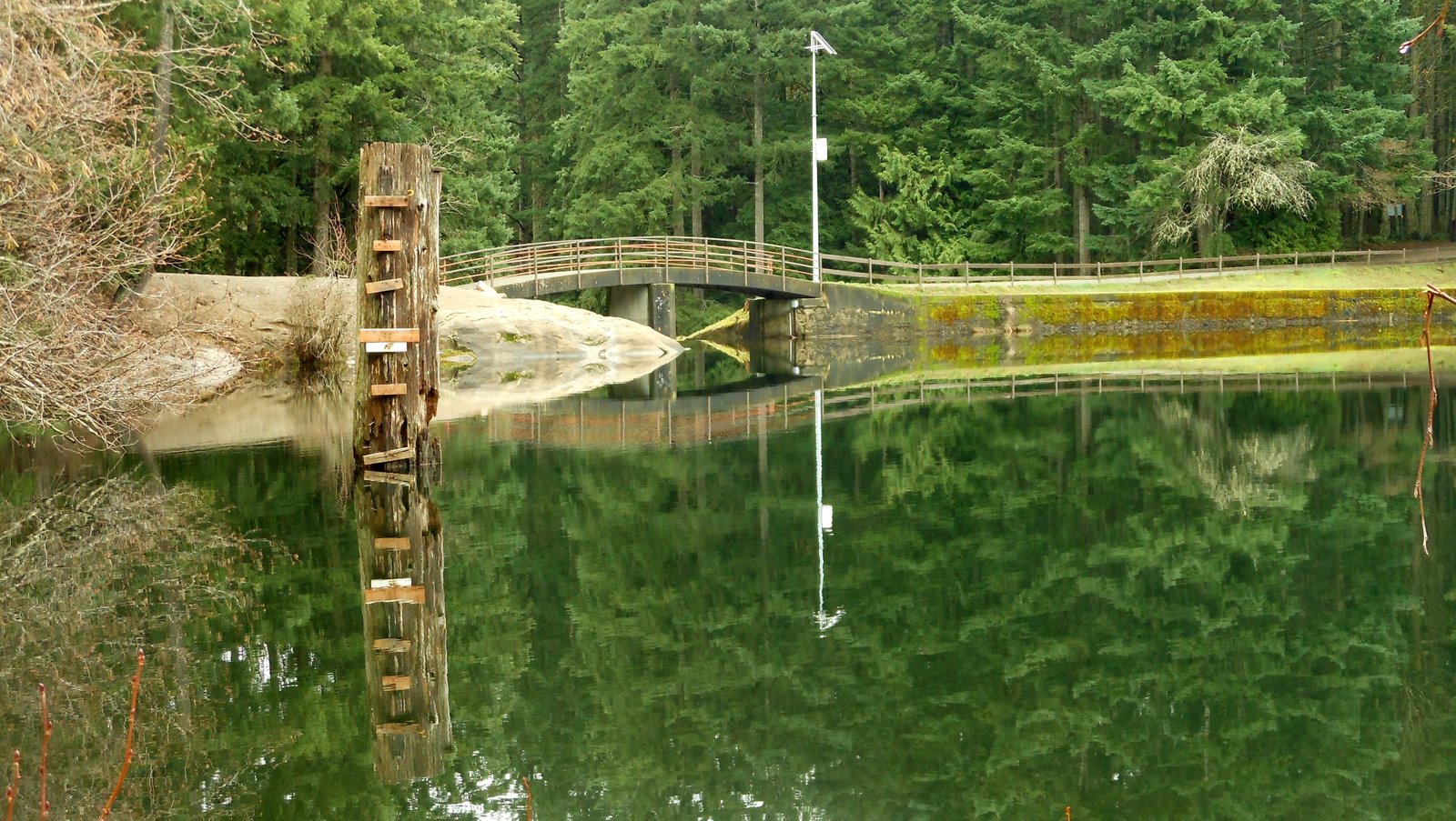
Nanaimo - Colliery Dam Park
Nanaimo - Colliery Dam Park
- View on Panoramio
- Tags: 2013, British Columbia, Canada, frtzw906, Nanaimo, park, Vancouver Island, water,
- Picture taken here: 49° 8' 59.61" N 123° 57' 45.08" W
 |
| Nanaimo - Colliery Dam Park |
Lillooet - Roundup At The Diamond-S Ranch
Lillooet - Roundup At The Diamond-S Ranch (This calf is sticking close to her mom!)
- View on Panoramio
- Tags: 2013, British Columbia, Canada, Cariboo, Pavilion,
- Picture taken here: 50° 53' 52.38" N 121° 46' 29.74" W
 |
| Lillooet - Roundup At The Diamond-S Ranch (This calf is sticking close to her mom!) |
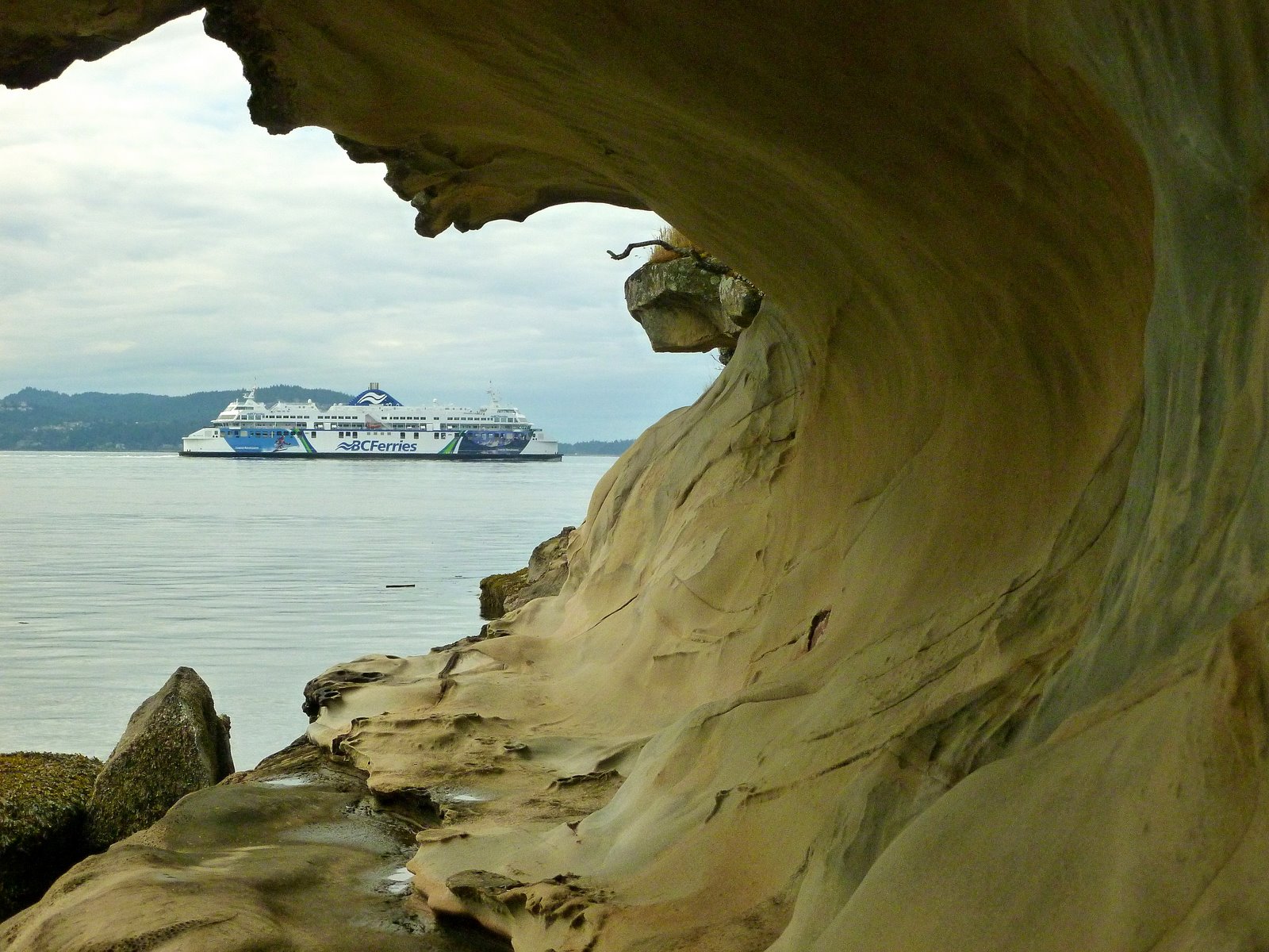
Gabriola Island - Malaspina Galleries
Gabriola Island - Duke Point ferry framed by Malaspina Galleries...
- View on Panoramio
- Tags: 2013, British Columbia, Canada, ferry, Gabriola Island, Nanaimo, Vancouver Island, water,
- Picture taken here: 49° 11' 29.41" N 123° 52' 19.98" W
 |
| Gabriola Island - Duke Point ferry framed by Malaspina Galleries... |
Labels:
boat,
British Columbia,
Canada,
ferry,
frtzw906,
island,
Panoramio,
Reise Fotos,
Reiseführer,
Salish sea,
shore,
Tourism,
Vancouver Island,
water
Location:
Gabriola, BC, Canada
Whistler - When Not A Ski Resort, Then Mountain Biking
Whistler - When Not A Ski Resort, Then Mountain Biking May 23. Plenty of mountain biking today...
- View on Panoramio
- Tags: 2013, British Columbia, Canada, frtzw906,
- Picture taken here: 50° 6' 48.11" N 122° 57' 14.59" W
 |
| Whistler - When Not A Ski Resort, Then Mountain Biking May 23. Plenty of mountain biking today... |
Lillooet - Footbridge Across The Fraser River
Lillooet - Footbridge Across The Fraser River
- View on Panoramio
- Tags: 2013, British Columbia, Canada, Fraser River, frtzw906, Lillooet, picnik, river, water,
- Picture taken here: 50° 42' 41.98" N 121° 54' 42.87" W
 |
| Lillooet - Footbridge Across The Fraser River |
Labels:
British Columbia,
Canada,
Cariboo Chilcotin,
Fraser River,
frtzw906,
Lillooet,
Panoramio,
Reise Fotos,
Reiseführer,
Tourism,
water
Location:
Lillooet, BC, Canada
Vancouver - Downtown
Downtown Vancouver as seen from Stanley Park...
- View on Panoramio
- Tags: 2013, British Columbia, Canada, frtzw906, Vancouver, water,
- Picture taken here: 49° 17' 54.29" N 123° 7' 15.98" W
 |
| Downtown Vancouver as seen from Stanley Park... |
Ucluelet - The Aquarium
Ucluelet - The Aquarium
- View on Panoramio
- Tags: 2013, boat, British Columbia, Canada, frtzw906, Long Beach, Ucluelet, Vancouver Island, water,
- Picture taken here: 48° 56' 35.21" N 125° 32' 44.26" W
 |
| Ucluelet - The Aquarium |
Labels:
boat,
British Columbia,
Canada,
frtzw906,
Panoramio,
Reise Fotos,
Reiseführer,
Tourism,
Ucluelet,
Vancouver Island,
water
Location:
Ucluelet, BC, Canada
Friday, 20 March 2015
Powell River - Texada Island Ferry (North Island Princess)
Powell River - Texada Island Ferry (North Island Princess)
- See at Panoramio
- Tags: 2012, August, boat, British, Columbia, Canada, ferry, frtzw906, Powell River, Salish Sea, vacation, water,
- Photo taken here: 49° 50' 13.35" N 124° 31' 47.33" W
 |
| Powell River - Texada Island Ferry (North Island Princess) |
Texada Island - Idyllic Camp At Mouat Bay
Texada Island - Idyllic Camp At Mouat Bay
- Visit at Panoramio
- Tags: 2012, beach, British Columbia, Canada, frtzw906, Texada Island, water,
- Photo taken here: 49° 38' 24.29" N 124° 26' 27.45" W
 |
| Texada Island - Idyllic Camp At Mouat Bay |
Port Alberni - McLeans Historic Steam Sawmill
Alberni - McLeans Historic Steam Sawmill
- See here at Panoramio
- Tags: 2012, Alberni, British Columbia, Canada, frtzw906, park, Port Alberni, Vancouver Island, water ,
- Picture taken here: 49° 18' 36.42" N 124° 49' 36.90" W
 |
| Alberni - McLeans Historic Steam Sawmill |
Nanaimo - The "Neck" Of Neck Point
The isthmus that is Neck Point's neck...
- See here at Panoramio
- Tags: 2012, beach, British Columbia, Canada, frtzw906, Georgia Strait, Nanaimo, Neck Point, park, Salish Sea, Strait of Georgia, Vancouver Island, water,
- Picture taken here: 49° 14' 10.12" N 123° 57' 51.01" W
 |
| The isthmus that is Neck Point's neck... |
Nanaimo - Harbour Shrouded In Fog
Nanaimo - Harbour Shrouded In Fog
- View on Panoramio
- Tags: 2013, >100, >50, boat, British Columbia, Canada, frtzw906, Nanaimo, Vancouver Island, water,
- Picture taken here: 49° 10' 2.67" N 123° 56' 6.32" W
Labels:
boat,
British Columbia,
Canada,
dock,
frtzw906,
Nanaimo,
Panoramio,
Reise Fotos,
Reiseführer,
Salish sea,
shore,
Tourism,
Vancouver Island,
water
Location:
Harbour Air, Nanaimo, BC, Canada
Hope - Carved Statue Of A Gold Miner
The village of Hope does a good job of displaying carvings along the streets...
- View on Panoramio
- Tags: 2013, >50, British Columbia, Canada, Fraser River, frtzw906, Hope,
- Picture taken here: 49° 22' 46.04" N 121° 26' 29.23" W
 |
| Hope - Carved Statue Of A Gold Miner |
Victoria - MV Coho (To Port Angeles) Docked
MV COHO, ferry to USA, in Victoria harbour...
- View on Panoramio
- Tags: 2013, >50, boat, British Columbia, Canada, frtzw906, Vancouver Island, Victoria, water,
- Picture taken here: 48° 25' 16.25" N 123° 22' 15.25" W
Labels:
boat,
British Columbia,
Canada,
dock,
ferry,
frtzw906,
Panoramio,
Reise Fotos,
Reiseführer,
Tourism,
Vancouver Island,
Victoria,
water
Location:
Victoria, BC, Canada
Brentwood Bay - Lowtide Snapshot
Blue Bayou restaurant on the Brentwood Bay waterfront...
- View on Panoramio
- Tags: 2013, >100, Brentwood Bay, British Columbia, Canada, frtzw906, Saanich, Vancouver Island, water,
- Picture taken here: 48° 34' 20.53" N 123° 27' 49.51" W
 |
| Blue Bayou restaurant on the Brentwood Bay waterfront... |
Nanaimo - Marshy Part Of Neck Point Park
March mist descends upon Neck Point Park...
- View on Panoramio
- Tags: 2013, >100, British Columbia, Canada, frtzw906, Nanaimo, Neck Point, park, picnik, trail, Vancouver Island, walk,
- Picture taken here: 49° 14' 2.13" N 123° 58' 1.51" W
 |
| March mist descends upon Neck Point Park... |
Quesnel - Wooden Footbridge Over The Fraser River
Longest wooden footbridge in the world... 255 metres...
- View on Panoramio
- Tags: 2013, >50, British Columbia, Canada, Cariboo, Fraser River, frtzw906, Quesnel, river, water,
- Picture taken here: 52° 58' 31.00" N 122° 30' 9.43" W
 |
| Longest wooden footbridge in the world... 255 metres... |
Labels:
British Columbia,
Canada,
Cariboo,
Cariboo Chilcotin,
Fraser River,
frtzw906,
Panoramio,
park,
Reise Fotos,
Reiseführer,
Tourism,
water
Location:
Quesnel, BC, Canada
Fanny Bay - Sea Lions Awaiting A Handout
Denman Island, as seen from Fanny Bay...
- View on Panoramio
- Tags: 2013, animal, boat, British Columbia, Canada, Fanny Bay, frtzw906, picnik, Vancouver Island, water,
- Picture taken here: 49° 30' 26.62" N 124° 49' 38.13" W
 |
| Fanny Bay - Sea Lions Awaiting A Handout |
Silva Bay - Kayak Season Awaits
Silva Bay - Kayak Season Awaits
- View on Panoramio
- Tags: 2013, British Columbia, Canada, Gabriola Island, Nanaimo, Vancouver Island, water,
- Picture taken here: 49° 9' 1.33" N 123° 41' 55.74" W
 |
| Silva Bay - Kayak Season Awaits |
Labels:
boat,
British Columbia,
Canada,
dock,
frtzw906,
Gabriola Island,
island,
Nanaimo,
Panoramio,
Reise Fotos,
Reiseführer,
Salish sea,
shore,
Tourism,
Vancouver Island,
water
Location:
Gabriola, BC, Canada
Vancouver - Harbour Cranes Seen From Stanley Park
A view of Vancouver's harbour from the Stanley Park seawall...
- View on Panoramio
- Tags: 2013, boat, British Columbia, Canada, frtzw906, park, picnik, Vancouver, water,
- Picture taken here: 49° 17' 54.22" N 123° 7' 15.36" W
 |
| Vancouver - Harbour Cranes Seen From Stanley Park |
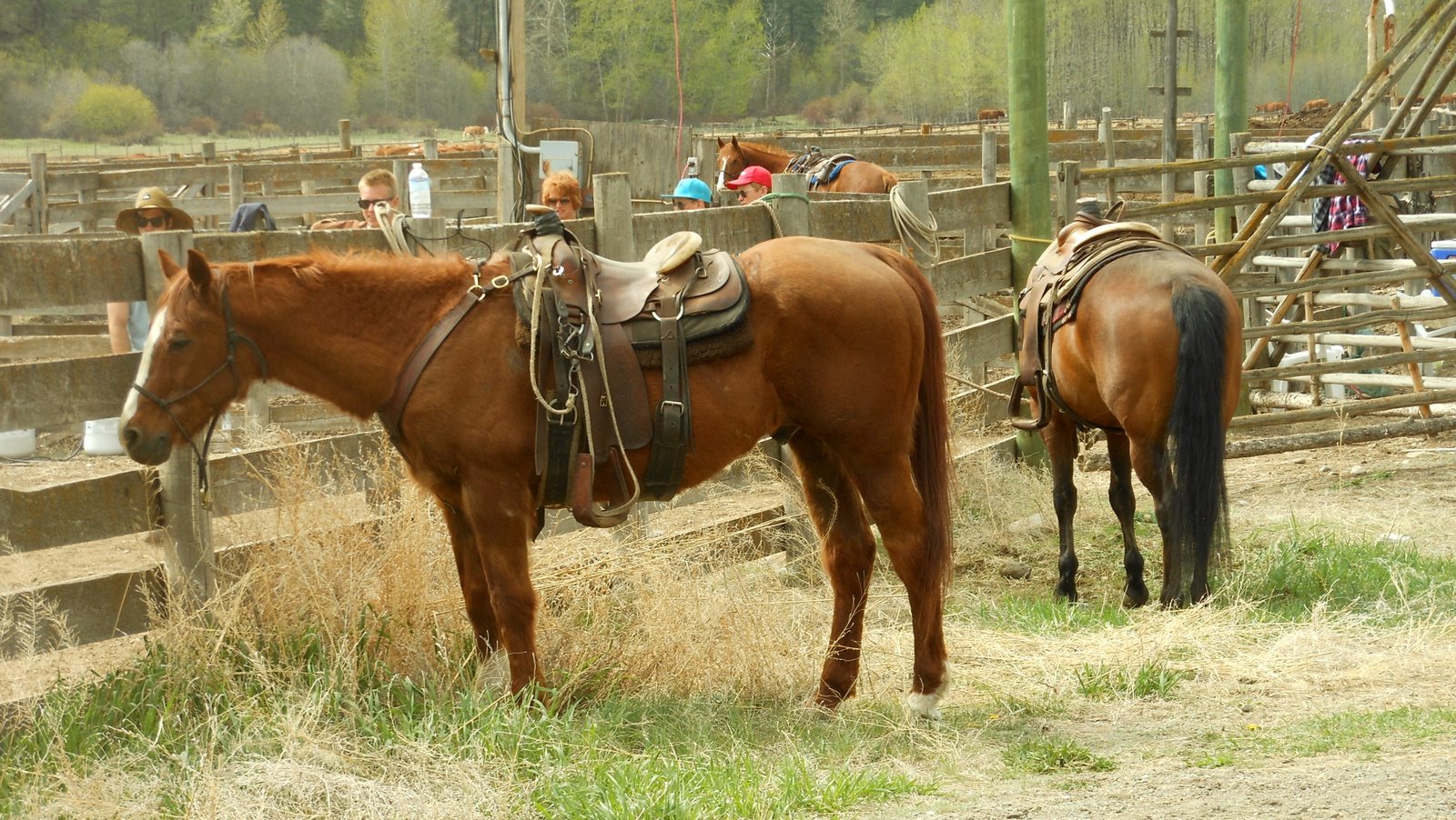
Lillooet - Rodeo Recess
A leisurely drive from Clinton to Lillooet, in early May (2013) took us past the spring roundup near Pavilion, BC. The Diamond-S ranch was in the process of branding young calves and we were privileged to be able to see the cowboys/girls at work. Sometimes, it seems, a break is also desirable.
- View on Panoramio
- Tags: 2013, >50, animal, British Columbia, Canada, Cariboo, frtzw906, Pavilion,
- Picture taken here: 50° 53' 52.38" N 121° 46' 29.74" W
 |
| Lillooet - Rodeo Recess |
Thursday, 19 March 2015
Old Alexandra Bridge
Old Alexandra Bridge
AD AD
- Picture was taken here: (49° 42' 27.03" N 121° 24' 56.71" W)
- On Panoramio
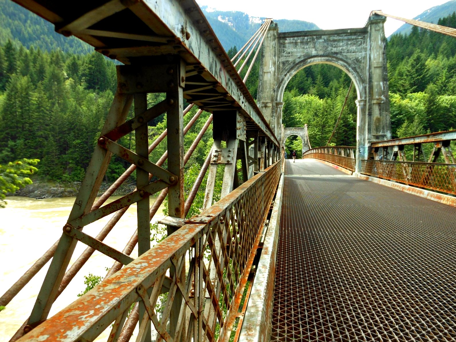 |
| Old Alexandra Bridge |
AD AD
Sidney, BC - Fish Market
Fish market in Sidney; customers await...
AD
AD
- View on Panoramio
- Tags: 2013 >100 bird British Columbia Canada frtzw906 Saanich Sidney Vancouver Island
- Picture taken here: (48° 38' 56.94" N 123° 23' 35.80" W)
 |
| Fish market in Sidney; customers await... |
Subscribe to:
Comments (Atom)


